Petrie's map of the cemeteries at Naqada : an updated version
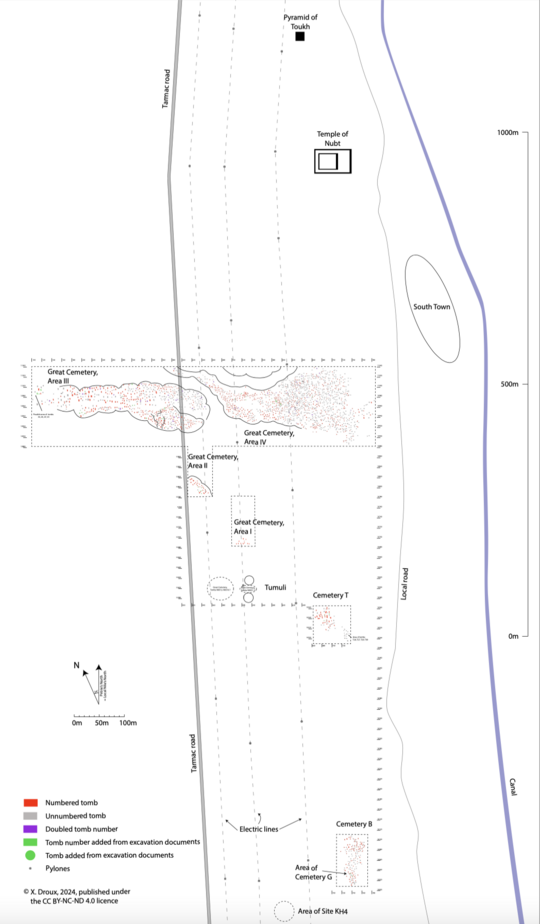
Fig. 1. Map of the cemeteries of Naqada (after Droux, 2024). click on map to download hi-resolution PDF.
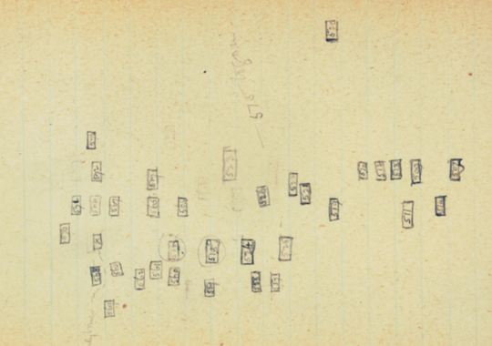
Fig. 2. Sketch-plan from Notebook 70 (Petrie Museum PMA/WFP1/1/99/70).
By Xavier Droux
The cemeteries of Naqada were excavated during a mission led by William Matthew Flinders Petrie in the winter 1894–1895. Over 3000 tombs were uncovered during what constitutes one of the largest and most ambitious archaeological endeavours of its time in Upper Egypt. The results were astounding, with the discovery of cemeteries dating to the predynastic period, the first ones to be investigated and documented; Petrie first mis-identified the remains for those of a foreing people who, he believed, invaded Egypt in historical times. The error was quickly understood by Jacques de Morgan and, ultimately, Petrie agreed with his French colleages.
A large amount of documentary material written during the excavation of these cemeteries by Petrie and members of his team have survived to this day. I have conducted a thorough review of this material, especially the excavation notebooks. I realised that data was scattered occasionally through the pages offered new evidence as to the location of many tomb, which has allowed me to produce a revision of the map of the cemeteries (Droux 2024: Revisiting Petrie’s excavations at Naqada: cross-matching the available documentary evidence and new digital map. Interdisciplinary Egyptology).
The map of the Great Cemetery (= Cemetery N), Cemetery B, and Cemetery T was first published in Petrie and Quibell's Naqada & Ballas (pl. LXXXVI). Drawn at a very large scale, this map contained a vast number of tombs, most of them without number label, and several errors were visible, especially in the form of doubled tomb numbers. During excavation, the team first kept track of the location of the tombs by writing short topographical comments in their notebooks next to the tombs top plans; later, as the scope of the work increased, they drew small sketch-plans (see Fig. 2). This new data is published in extenso in Droux, X. 2024: 'Revisiting Petrie’s excavations at Naqada: cross-matching the available documentary evidence and new digital map', Interdisciplinary Egyptology 3 (1): 1–59. DOI:10.25365/integ.2024.v3.4.
This research presented me with the opportunity to update the published map and create a new, colour-coded, digital map. Tombs that Petrie had left out are added and others are identified by their original number. Several duplication errors have been corrected and Cemetery G, the location of which had never been indicated by the excavators, is now placed in the vicinity of Cemetery B and likely overlapped with some or all of it.
You can click on the map (Fig. 1) to download a high-resolution version in PDF format, published under the CC BY-NC-ND 4.0 license. Additional corrections and additions will be included in this map if, and when, new evidence and research allows us to do so.